Timelines
History 1
I can apply the conventions of B.C.E. and C.E. or B.C. and A.D. to arrange an analyze events in chronological order.
I can apply the conventions of B.C.E. and C.E. or B.C. and A.D. to arrange an analyze events in chronological order.
- I can explain the purpose of a timeline.
- I can explain the purpose of a multi-tier timeline.
- I can explain chronological order.
- I can construct a timeline with evenly spaced intervals.
- I can construct a multi-tier timeline.
- I can locate dates on a timeline using the conventions of B.C. and A.D. or B.C.E. and C.E.
- I can arrange historical events on a timeline using the conventions of B.C. and A.D. or B.C.E. and C.E.
- I can apply the use of chronological conventions to an existing timeline.
|
|
|
Geography Influence
History 2a
I can describe the influence of geography on the development of unique civilizations in India, Egypt, China, and Mesopotamia.
I can describe the influence of geography on the development of unique civilizations in India, Egypt, China, and Mesopotamia.
- I can identify the geographic characteristics of India.
- I can identify the geographic characteristics of Egypt.
- I can identify the geographic characteristics of China.
- I can identify the geographic characteristics Mesopotamia.
- I can cite the benefits of living near rivers.
- I can explain why rivers contributed to the development of civilizations.
- I can explain how crop surpluses influence the growth of cities.
- I can draw conclusions from features shown on a map.
Eastern Hemisphere Civilizations
History 2b
I can describe the governments, cultures, economic systems, technologies and agricultural practices and products of early civilizations and their enduring influence in the Eastern Hemisphere today.
I can describe the governments, cultures, economic systems, technologies and agricultural practices and products of early civilizations and their enduring influence in the Eastern Hemisphere today.
- I can define government, culture, economic system, technology, and agriculture.
- I can describe the government, culture, economic system, technology and agricultural practices of ancient Mesopotamia.
- I can describe the government, culture, economic system, technology and agricultural practices of ancient Egypt.
- I can describe the government, culture, economic system, technology and agricultural practices of ancient India.
- I can describe the government, culture, economic system, technology and agricultural practices of ancient China.
- I can define enduring influence.
- I can cite examples of the enduring influence of ancient Mesopotamia.
- I can cite examples of the enduring influence of ancient Egypt.
- I can cite examples of the enduring influence of ancient India.
- I can cite examples of the enduring influence of ancient China.
Mesopotamia
- I can identify the geographic characteristics Mesopotamia.
- I can describe the government, culture, economic system, technology and agricultural practices of ancient Mesopotamia.
- I can explain why rivers contributed to the development of civilizations.
- I can explain how crop surpluses influence the growth of cities.
- I can cite examples of the enduring influence of ancient Mesopotamia.
Maps
Geography 3a
I can use appropriate maps, globes and geographic tools to gather, process and report information about people, places and environments.
I can use appropriate maps, globes and geographic tools to gather, process and report information about people, places and environments.
- I can define and explain the work of cartographers.
- I can identify and explain the purpose of maps and globes.
- I can identify and explain the tools modern cartographers including satellite images, aerial photographs, and geographic information systems.
- I can use a map key to identify features on a map.
- I can use map symbols to answer questions about location of places.
- I can use a map scale to determine distance.
- I can use cardinal and intermediate directions to describe relative location of characteristics.
- I can determine the best geographic tool to use to acquire specific information.
- I can apply my understanding of basic properties of geographic tools to process and report information about people, places and environments.
Geography 3b
I can explain that maps are created for specific purposes and represent the context in which they were created.
I can explain that maps are created for specific purposes and represent the context in which they were created.
- I can explain the purpose of a physical map.
- I can explain the purpose of a climate map.
- I can explain the purpose of a topographic map.
- I can explain the purpose of a resource or economic activity map.
- I can explain the purpose of a political map.
- I can explain why maps in the past may have been incomplete or different from current maps.
- I can apply understanding of map purposes to a specific geographic question.
- I can explain the cultural, time, and place influences evident on a particular map
Longitude and Latitude
Geography 4:
- I can use latitude and longitude coordinates to identify absolute location.
- I can identify a specific place along a line of latitude.
- I can identify a specific place along a line of longitude.
- I can define absolute location.
- I can identify lines of latitude on a map or globe.
- I can identify lines of longitude on a map or globe.
Latitude and Longitude PowerPoint
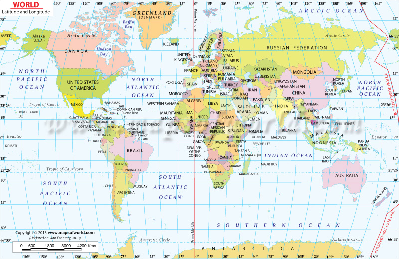
World Map
Longitude and Latitude Practice #1
Longitude and Latitude Practice #2
Longitude and Latitude Practice #3
Longitude and Latitude Practice #4
Longitude and Latitude Practice #5
World Map
Longitude and Latitude Practice #1
Longitude and Latitude Practice #2
Longitude and Latitude Practice #3
Longitude and Latitude Practice #4
Longitude and Latitude Practice #5
Regions
Geography 5
I can use various criteria to describe, classify and compare regions within the Eastern Hemisphere.
I can use various criteria to describe, classify and compare regions within the Eastern Hemisphere.
- I can identify various criteria used to determine a region.
- I can explain how landforms are used to describe a region.
- I can explain how climate is used to describe a region.
- I can explain how population is used to describe a region.
- I can explain how culture is used to describe a region.
- I can explain how economic characteristics are used to describe a region.
- I can classify a region on a map using provided criteria.
- I can compare regions of the Eastern Hemisphere based on landform, climate and cultural characteristics.
Human/Environment Interactions
Geography 6
I can explain how variations among physical environments in the Eastern Hemisphere influence human activities.
I can explain how variations among physical environments in the Eastern Hemisphere influence human activities.
- I can define and cite examples of physical features.
- I can identify variations in physical features in regions of the Eastern Hemisphere.
- I can explain how waterways impact human settlement patterns.
- I can explain how harsh climates impact human settlement patterns.
- I can identify ways human modify the environment.
- I can explain how human modifications are connected to needs in particular environments.
- I can explain unintended consequences of various human modifications to the environment.
Religion
Geography 8a
I can explain how tradition and diffusion have influenced modern cultural practices and products in the Eastern Hemisphere.
I can explain how tradition and diffusion have influenced modern cultural practices and products in the Eastern Hemisphere.
- I can define and give examples of tradition.
- I can define and give examples of diffusion.
- I can define and give examples of cultural practices.
- I can define and give examples of cultural products.
- I can explain how tradition has influenced modern cultural practices and products.
- I can explain how diffusion has influenced modern cultural practices and products.
Geography 8b
I can describe the influence of religious diffusion in the modern world.
I can describe the influence of religious diffusion in the modern world.
- I can identify the geographic origins, founding leaders and teachings of Buddhism.
- I can identify the geographic origins, founding leaders and teachings of Christianity.
- I can identify the geographic origins, founding leaders and teachings of Hinduism.
- I can identify the geographic origins, founding leaders and teachings of Islam.
- I can identify the geographic origins, founding leaders and teachings of Judaism.
- I can explain the influence of Buddhism on the modern world.
- I can explain the influence of Christianity on the modern world.
- I can explain the influence of Hinduism on the modern world.
- I can explain the influence of Islam on the modern world.
- I can explain the influence of Judaism on the modern world.
- I can draw the diffusion of world religions on a map.
|
|
Use this video to help with the fill in the blank on Google Classroom. You may have to replay it a couple of times.
|
|
PowerPoint for fill in the blank.
|
| ||
Review
Types of Governments
Economics
Map Skills Practice
Egypt
MONDAY NOVEMBER 21 SOCIAL STUDIES TEST- MESOPOTAMIA
FRIDAY SEPTEMBER 16 SOCIAL STUDIES TEST
Polleverywhere
Respond to Class Poll Here